The Heath Merge Prospect
Heath Merge is permitted for drilling until 2029 (MYAB permit granted in 2024)
Heath Merge is a high-ranking target due to:
- diorite and layered diorite with K-feldspar-sericite-magnetite alteration,
- multiple rock samples >1000 ppm Cu,
- anomalous soils >10x crustal abundance Cu,
- high V/Sc:Sc ratios at the Heath #3 outcrop, and
- magnetic highs and moderate relative conductivity.
The target is a combination of the Heath #1, Heath East, and Heath #3 targets, with a total area of 1.2 km2. This target is open to the north and the south, with a potential size of ~4 km2, due to proximal anomalous soils, geophysics, and dioritic rocks.
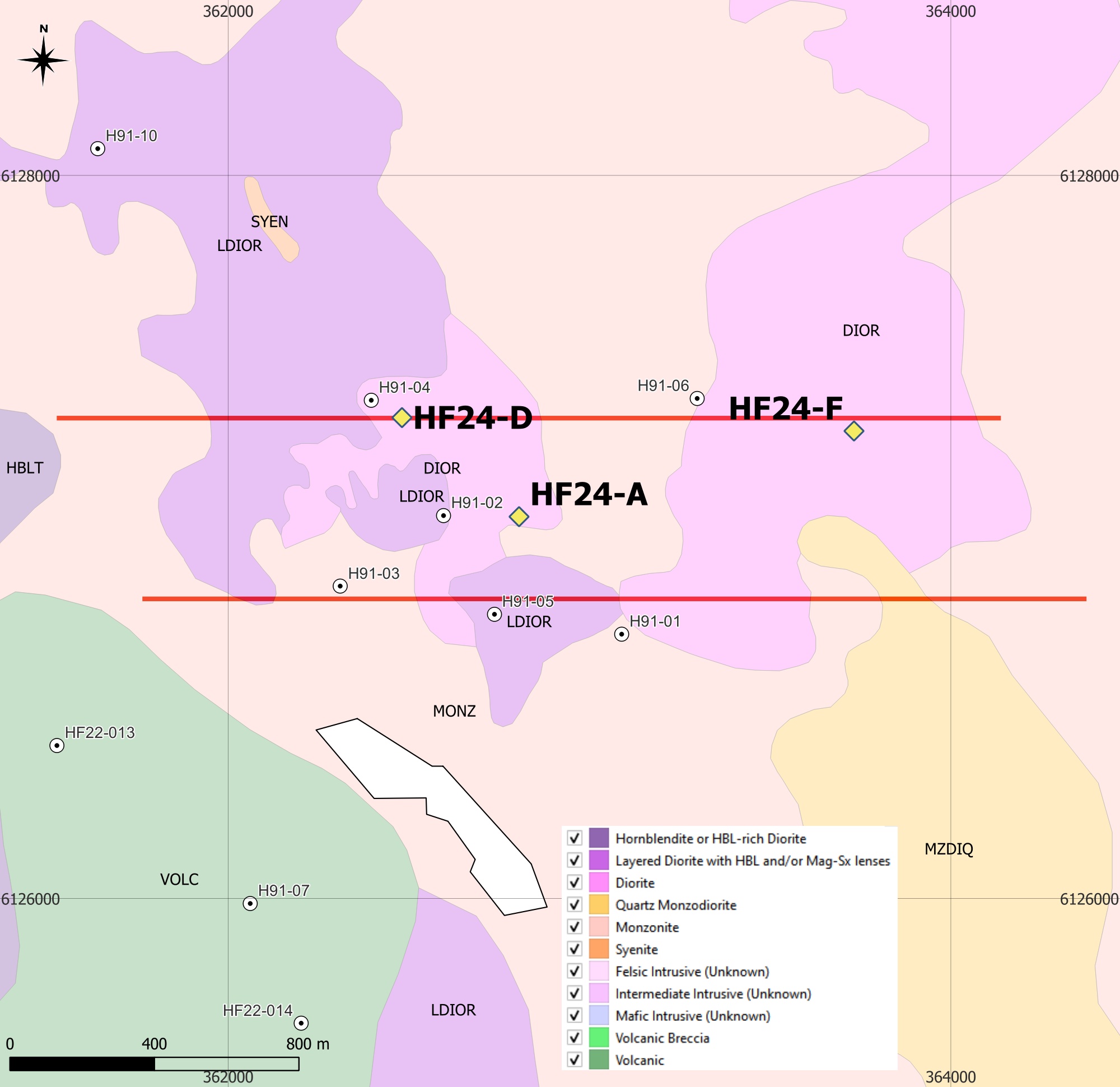
Three recommended drilling sites are shown in the adjoining map, together with the location of IP lines surveyed during 2023.
The white lozenze shape is the size of the block cave in the New Afton mine - provided as an example of a target size and shape.

IP Chargeability Inversion Results beneath the two lines surveyed
(Left: Line 850; Right: Line 1350) (linear colour scale max 20 mV/V)
Topo profiles at -350 and -500 m below surface are shown to assist in determining the depth of investigation (DOI).


Heath Merge Geochemistry
Soils are highly anomalous in copper
Heath Merge displays highly anomalous copper in soils over an area of approximately 2km by 2km, similar to the size of the anomalous copper in soils footprint over the Mt Milligan deposit (See: "A Geo-Exploration Atlas of the Mt Milligan Porphyry Copper-Gold District", a 139Mb pdf report available here from Geoscience BC.).
Soil copper values are displayed in the online interactive map of the property availabe here. An Excel file with all project soil, silt and rock assay results suitable for import into a GIS is available from the Reports and Data page of this website.
The white lozenze shape is the size of the block cave in the New Afton mine - provided as an example of a target size and shape.
All data are available for download here.


Heath Merge Petrology
Detailed petrographic descriptions of samples from across the property are available.
Redton's petrographic and spectral work is summarised in a 2022 presentation and includes a section on Heath. The presentation is available on the Reports and Data page.
